.png)
Arrive 1–3 Hours After High Tide at Crab Island

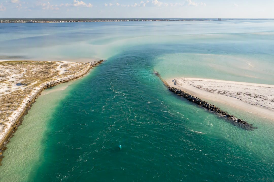
Right now, the smart move is to check the NOAA Destin East Pass tide station before you load the cooler. A typical high tide near Crab Island is often around 8 feet and a low tide near 1 to 2 feet, and NOAA publishes the exact times for today down to the minute. If the next high tide is still a few hours out, wait for it. Arriving 1 to 3 hours after high tide gives you the deepest sandbar water and the best shot at clear conditions for wading, floating, or snorkeling.
TL;DR:
The best time for Crab Island activities is 1 to 3 hours after high tide, when depth is sufficient and currents are calmer.
Rely on NOAA’s Destin East Pass tide predictions, as they are based on actual water level sensors and are more accurate than third-party forecasts.
Tide height is relative to Mean Lower Low Water, so a 1.3-foot low tide doesn’t guarantee specific water depth over the sandbar.
The strongest currents occur near East Pass during peak tide changes, posing risks to swimmers and anchor stability.
Weather, wind, and moon phases can significantly alter tide heights and water clarity, so check live forecasts and conditions on the day of your trip.
Table of Contents
Where to Check Crab Island Tides Today
Every reliable tide prediction for Crab Island traces back to one government station, even when it shows up on a tourism blog with a local logo slapped on top. Knowing which sources actually pull from that station, and which just repackage it, saves you from checking three apps that all say the same thing.
NOAA Tides & Currents runs the official Destin East Pass tide predictions, station ID 8454049. This is the source every other app, chart, and captain’s app ultimately references. NOAA’s output looks basic, a plain table or graph, but it’s the only one built from actual water level sensors and harmonic tide calculations rather than someone else’s forecast model.
Three other sites make that same data easier to digest for a casual visitor:
Tide-forecast.com turns the NOAA numbers into an hourly graph and tide chart that’s easier to scan on your phone than a raw data table.
Surfline publishes a monthly tide calendar, handy if you’re booking a trip two or three weeks out and want to see the pattern across several days at once.
USHarbors offers a stripped down tide table for the Destin/East Pass area for a fast lookup with no graph, no clutter.
A typical entry on any of these looks like this: “High Tide: 2:06 PM, 8.17 ft” or “Low Tide: 8:41 AM, 1.32 ft.” That height number is measured in feet above a reference point called Mean Lower Low Water, which is a fancy way of saying it’s not measuring straight up from the sea floor, it’s measuring relative to the average lowest tide NOAA has recorded at that station over a multiyear cycle.
Pro Tip: Bookmark the NOAA station page directly instead of a third-party app. Third-party sites occasionally lag a day behind when NOAA updates its predictions for a new tidal epoch, and that one-day gap is exactly the kind of thing that ruins a morning at the sandbar.
Local tourism sites sometimes publish their own Destin East Pass tide chart pages, and those are almost always just NOAA’s numbers with a different header. There’s nothing wrong with using them, just know you’re not getting a second opinion, you’re getting the same forecast in a nicer font.
How High and Low Tide Change the Sandbar
The sandbar that makes Crab Island famous doesn’t move, but the water sitting on top of it swings by several vertical feet over a single day, and that swing changes everything about what you can actually do out there.
At low tide, parts of the sandbar can sit in ankle to knee-deep water, sometimes barely covered at all during an extreme low. That’s great for standing around with a cooler float, but it also means less clearance under your boat and a much higher chance of running aground if your captain doesn’t know the exact contour of the bar. At high tide, depth over the bar is usually sufficient to swim, float, and anchor without scraping bottom.
Water clarity follows a related but separate pattern. As the tide rises, cleaner Gulf water pushes in through East Pass and mixes into the bay, often improving visibility right around the incoming tide and the couple of hours after high tide hits. Wind is the wildcard: a stiff southwest wind or a passing storm can churn up sediment and wreck that clarity no matter what the tide chart says, so the chart tells you the baseline, not the guarantee.
Current speed also picks up near the pass itself, especially during the two hours around a tide change when the largest volume of water is moving in or out.
Expect the strongest current pull closest to East Pass, not out in the open sandbar area.
Anchoring holds better on the sandbar’s flatter sections than near its drop-off edges.
Uneven or holed-out bottom sections near the channel can catch anchors or ankles by surprise.
Pro Tip: If your boat’s anchor keeps dragging, you’re probably sitting on a harder-packed patch near the drop-off. Move 20 to 30 feet toward the shallower flat and try again.
How to Read a Crab Island Tide Chart Without Getting Confused
Tide data comes in three basic formats, and picking the wrong one for your situation is the most common mistake first-time visitors make.
Tide tables list just the high and low times and heights for the day, good for a quick glance the morning of your trip.
Graph charts, like the ones on Tide-forecast, plot the full rise-and-fall curve, useful for seeing exactly how much water you’ll have at, say, 11 AM versus 2 PM.
Hourly prediction tables break the day into hour-by-hour height estimates, the most precise option if you’re trying to time an exact arrival for sandbar depth.
For Crab Island specifically, the Destin East Pass NOAA station is the right one to trust, not a station further down the coast or across the bay. Stations even 10 or 15 miles away can show meaningfully different timing because of how the local geography funnels water in and out.
A few details trip people up every season. Heights are reported in feet relative to Mean Lower Low Water, not actual water column depth, so a “1.3 ft” low tide reading doesn’t mean the sandbar has 1.3 feet of water on it everywhere, it means the water surface sits 1.3 feet above that reference datum. Times are shown in local clock time and do shift with Daylight Saving Time, so double check you’re not reading a chart still set to standard time in the spring or fall changeover. And two consecutive high tides in the same day are rarely identical, thanks to the mixed tide pattern common along the Florida Panhandle, so don’t assume tomorrow’s 8 AM high matches today’s.
For trip planning further out, Surfline’s monthly calendar view and USHarbors’ printable tables both let you scan several days at once without opening a new page for each one.
Which Tide Is Best for Your Crab Island Plans?
The right tide window depends less on some universal “best time” and more on what you actually plan to do once you’re floating out there.
Sandbar wading and standing floats: arrive 1 to 3 hours after high tide, when depth is deep enough to float comfortably but the current has settled down from the peak flow.
Swimming and snorkeling: aim for the two hours surrounding high tide itself, when depth and clarity both tend to peak together.
Clear-water photos: mid-to-high tide windows usually give the best combination of light penetration and reduced sediment, according to clarity notes on Tide-forecast’s Crab Island pages.
Shelling or exploring shallow edges: low tide exposes more sandbar surface and nearby shallows, though you’ll trade that for less swimmable depth.
Late spring through late summer tends to bring the calmest water overall, since Panhandle storm activity and cold fronts that stir up the Gulf are less frequent than in fall and winter. That seasonal calm matters more for clarity than the tide phase does on any given day. A dead-calm December afternoon at low tide can look better than a windy July morning at high tide.
Treat every recommendation here as a starting point, not a guarantee. Check the live NOAA prediction and a current wind forecast the morning of your trip, tide charts don’t account for a cold front that rolled through overnight.
Timing Your Day Trip: Arrival, Duration, and Safety Basics
A typical Crab Island outing runs 3 to 4 hours, and the tide will keep moving the entire time you’re anchored, so plan around the shift rather than a single snapshot.
Check the day’s NOAA high tide time before you leave the dock.
Aim to arrive 1 to 3 hours after that high tide for the best combination of sandbar depth and settled current, a rule of thumb echoed in local Crab Island Hours guidance.
Watch water depth around your anchor point as the tide starts falling later in your visit, especially if you arrived near high tide and plan to stay several hours.
If the water visibly starts dropping fast or current picks up noticeably near the pass, move away from the channel edge and check your anchor line.
Anchor on the flatter sandbar sections rather than near drop-offs, where uneven bottom and stronger flow near East Pass make holding ground harder. Keep life jackets accessible for anyone not confident swimming, especially kids on floats, since a rising afternoon breeze can push floats farther from the boat than people expect.
Pro Tip: Set a phone alarm for two hours after you anchor. That’s usually when tide-driven depth changes start becoming noticeable enough to reposition your boat if needed.
Why Crab Island Has Tides at All
Crab Island sits inside Choctawhatchee Bay, connected to the Gulf of Mexico through the narrow channel of East Pass. The moon’s gravitational pull, with a smaller contribution from the sun, drags Gulf water in and out through that pass twice a day in most cases, a pattern oceanographers call a mixed tide. That’s why you’ll typically see two high tides and two low tides in a 24 hour period, but rarely at the same height as their counterpart earlier or later in the day.
Because Crab Island isn’t open ocean, it doesn’t feel the tide directly, it feels the effect of water pushing through East Pass and spreading across the bay. That funnel effect is part of why current speed near the pass runs noticeably stronger than out over the sandbar itself, and why timing your trip around the tide schedule at the Destin East Pass station matters more here than it might at a beach directly on the open Gulf.
The bay’s shallow, semi-enclosed shape also means tidal range at Crab Island tends to run smaller and slower to change than what you’d see on an oceanfront pier a few miles away, which is part of why the sandbar stays usable across a wider window than a strict reading of “high tide only” would suggest.
Moon Phases, Weather, and How They Shift the Forecast
Tide height doesn’t stay constant day to day, and the moon is the biggest reason why. Around the full moon and new moon, gravitational pull from the sun and moon line up, producing spring tides with a bigger gap between high and low water. During the moon’s quarter phases, that pull partially cancels out, producing neap tides with a smaller, gentler swing.
For Crab Island, spring tides mean a deeper high tide window but also a lower, shallower low tide, worth knowing if you’re planning around a full moon weekend and expect consistent depth all day. Neap tide days tend to offer a more forgiving, steadier depth range with less dramatic change between high and low.
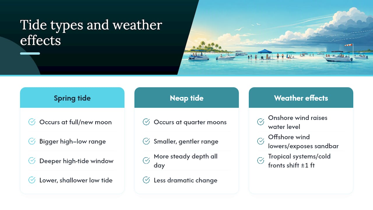
Weather overrides all of it when conditions turn. A strong onshore wind can push extra water into the bay and raise levels above what the tide chart predicts, while a strong offshore wind can do the opposite and expose more sandbar than expected. Tropical systems and cold front passages, common in the Panhandle from late fall through winter, can shift predicted tides by a foot or more in either direction. NOAA’s ocean service explainers cover this interaction between astronomical tides and weather-driven water level changes in more detail, and it’s worth a skim if you’re planning a trip during hurricane season or right behind a cold front.
Currents, Submerged Obstacles, and Other Tide-Driven Hazards
The biggest tide-related risk at Crab Island isn’t the sandbar itself, it’s the water moving around it, especially near East Pass where tidal flow concentrates into a narrower channel.
During peak incoming or outgoing tide, current near the pass can run strong enough to pull a weak swimmer or an unanchored float farther than they intended, faster than most people expect from water that looks calm on the surface. NOAA’s guidance on tidal currents and rip risk applies here even though Crab Island sits in a bay rather than on the open beach, the underlying mechanic, water forced through a narrow opening, is the same one that creates rip currents at Gulf-facing beaches nearby.
Submerged hazards are the other half of the risk. Sandbars shift shape over a season, and a drop-off that was gradual last summer can turn into a sharper ledge after a storm reshapes the bottom. At low tide, boat props and swimmers alike face a higher chance of contact with the bottom in areas that seemed plenty deep the week before. At high tide, that same ledge disappears from view but doesn’t disappear from the water, it just gets harder to see.
Boat traffic adds another layer. As more boats anchor closer together at low tide, when usable sandbar water is at a premium, swimmers moving between boats face more risk from prop wash and tight maneuvering near the channel edge.
Tide Windows Worth Avoiding at Crab Island
Two windows deserve extra caution, and both come down to timing rather than the tide phase being inherently dangerous on its own.
The hour or two right around peak incoming or outgoing tide near East Pass is when current speed through the pass is at its strongest. Swimmers, especially kids on floats, are better off staying well clear of the channel during that window rather than testing how far the pull actually reaches.
Extreme low tides, particularly the lower of the day’s two lows during a spring tide cycle, can expose enough of the sandbar that boat clearance becomes a real problem, and grounding risk goes up for anyone unfamiliar with the bar’s exact shape. If you’re piloting your own boat and don’t have local knowledge of the current contour, it’s worth avoiding an approach during that lowest window and waiting an hour for water to return.
Add a rising wind or an approaching front to either scenario and the smart move is simple: check the live NOAA prediction and a wind forecast together, and if both are working against you, push your visit back rather than fighting conditions the chart already warned you about.
What Locals and Boat Captains Actually Watch For
Most timing mistakes I see aren’t about picking a bad day, they’re about picking a bad hour on a good day. Visitors check the weather, see sunshine, and head out without glancing at what the tide’s doing, then wonder why the water’s murky or why the boat keeps drifting off anchor.
Operators who run this stretch of water constantly build their schedules around the tide chart first and the calendar second. Route choice matters too, coming in from the harbor side versus threading closer to East Pass changes how much current you fight along the way, and a captain who knows the bar’s current contour picks a landing spot accordingly instead of anchoring wherever the boat in front of them stopped.
[brand_signal] The pattern holds up trip after trip: arrive in that window after high tide, anchor away from the channel edge, and the sandbar behaves the way it’s supposed to. [testimonial]
[author_bio]
— Troy
Skip the Tide Math, Just Show Up
Reading five different tide charts before a trip is exactly the kind of hassle Crab-island-tours exists to remove. Instead of cross-checking NOAA against Tide-forecast against your own guesswork, you can book a guided trip and let a captain time the sandbar approach for you.
Outings typically include floats, an onboard restroom, and seating for many guests, plus you’re welcome to bring your own drinks. The captains running these trips watch the same Destin East Pass predictions covered above every single day, so the boat lands on the sandbar when depth and clarity are actually working in your favor, not whenever the schedule happened to land. You show up, and the trip’s logistics are handled for you. Check available dates and book your Crab Island trip before your preferred slot fills up.
Sources
Recommended
Comments